
The following points are drawn from the report's own text, tables and specialist summaries. Each is either an impact the report itself flags as unresolved, a gap in the evidence, or a place where the report gives conflicting figures. They are offered so that readers can decide for themselves what to raise.
Eskom Nuclear Power Plant (up to 5 200 MW): Final Environmental Scoping Report for Thyspunt and Bantamsklip
Closed to be confirmed (SAST) · Environmental authorisation, DFFE ref 14/12/16/3/3/2/2806
The plain-language summary and the potential concerns on this page are prepared by ShapeSFB from the official documents. They are summaries, not official documents. The source documents are listed under Documents received below.
In short
- Eskom Holdings SOC Limited proposes a new nuclear power plant of up to 5 200 MW at either Thyspunt near Oyster Bay in the Kouga municipality or Bantamsklip in the Western Cape.
- This is the Final Scoping Report of June 2026, prepared by WSP Group Africa (Pty) Ltd, which sets out what the next stage, the full Environmental Impact Assessment, will study.
- The report recommends that Bantamsklip be scoped out and that Thyspunt be carried forward as the preferred site.
- Several impacts at Thyspunt stay high even after mitigation, including impacts on critical biodiversity areas, dune wetlands, the chokka squid fishery and the visual character of the coast.
- Thyspunt is provisionally protected by SAHRA as a Grade I cultural landscape, and that heritage process is not yet finished.
What is being proposed?
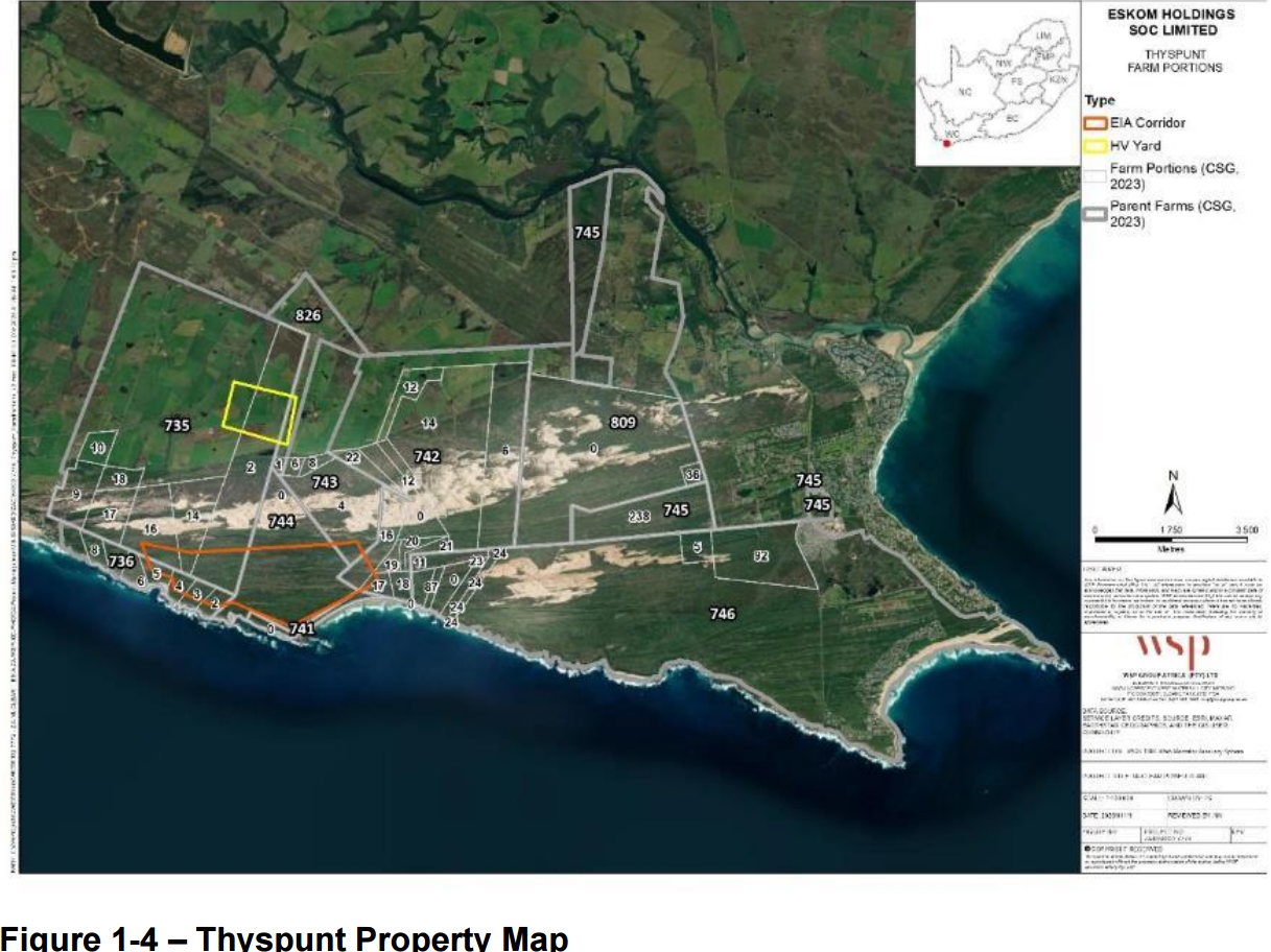
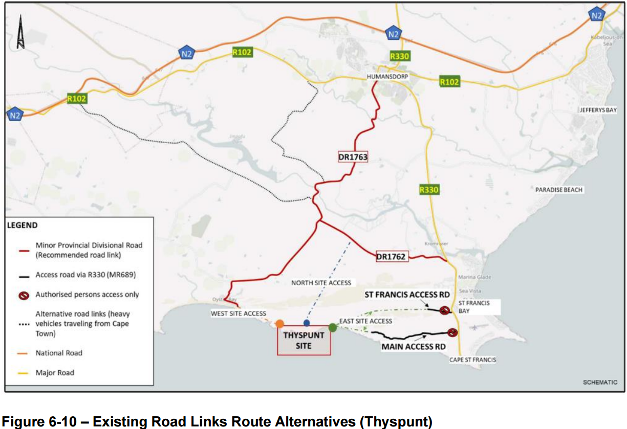
Eskom Holdings SOC Limited proposes to build, operate and eventually decommission a new nuclear power plant with an export capacity of up to 5 200 MW (report p. 7, p. 164). Two candidate sites were assessed side by side: Thyspunt in the Kouga Local Municipality in the Eastern Cape, about 7 km from Oyster Bay and about 11 km from St Francis Bay, and Bantamsklip in the Overstrand area of the Western Cape (p. 241). The competent authority that will decide is the national Department of Forestry, Fisheries and the Environment (DFFE), reference 14/12/16/3/3/2/2806 (p. 4, p. 85). The environmental assessment practitioner is WSP Group Africa (Pty) Ltd (p. 67).
The document now in circulation is the Final Environmental Scoping Report of June 2026 (p. 1). Scoping is the first of two stages. It sets the boundaries of the study, records the issues raised by the public, and sets out a Plan of Study for the full Environmental Impact Assessment that follows. It does not itself grant permission to build. The report states that the target completion date for the environmental authorisation process is "mid 2027" (p. 101).
The reactor technology has not been chosen. The assessment uses a "Plant Parameter Envelope", a technology neutral bounding approach that covers large conventional pressurised water reactors and small modular reactors, or a mixture (p. 7, p. 170). If the final design falls outside that envelope, a Part 2 amendment process would be needed (p. 170 to 171).
The buildable footprint is given as 250 ha at Thyspunt and 170 ha at Bantamsklip (p. 172). The plant would be cooled by seawater drawn through tunnels 1 000 m to 2 000 m offshore, at a once through flow of roughly 230 to 243 m3 per second, and returned to the sea about 12 degrees C warmer (p. 175, p. 279). Fresh water would come from a seawater reverse osmosis desalination plant, with brine discharged to the sea (p. 113, p. 283). Excavation would generate very large volumes of spoil, roughly 6.5 million m3 at Thyspunt and 10.1 million m3 at Bantamsklip, with offshore disposal identified as the preferred option at scoping level and a cut and fill option added after public comment (p. 281 to 282). Low and intermediate level radioactive waste would go to the existing Vaalputs facility in the Northern Cape, while high level waste (used fuel) would be stored on site (p. 190, p. 720).
The construction phase would last about 5 to 8 years and involve roughly 10 000 workers, with about 2 400 people on site during operation (p. 187, p. 669). The report states the plant would help meet the Integrated Resource Plan 2025 target of 5 200 MW of new nuclear capacity by 2039 and would reduce reliance on coal (p. 202, p. 208).
Following the scoping assessment, the report recommends "that the Bantamsklip site be scoped out of further consideration, and the Thyspunt site be further assessed as the preferred location alternative" (p. 781). It adds that Bantamsklip "is not fatally flawed and remains a viable site for an NPP" (p. 783). For the heritage work, the report states that "The EIA Phase will deal only with Thyspunt and all references to Bantamsklip will be removed" (p. 813).
Several major pieces of the project are outside this application and would need their own separate approvals: the transmission lines to the grid (to be applied for by the National Transmission Company of South Africa), the staff village, external access roads, off site construction camps, the water use licence, and the coastal waters discharge permits (p. 12, p. 169, p. 343). The Nuclear Installation Site Licence is a separate process run by the National Nuclear Regulator and is still under review, with a response anticipated in the last quarter of 2026 (p. 11 to 12).
Key terms in this application
Plain-language explanations of technical terms used here. See the full glossary.
- Critical Biodiversity Area (CBA)
- Land that should stay natural to meet biodiversity targets. Land identified as needing to stay in a natural or near-natural state to meet the area's biodiversity targets. CBA 1 is the highest flag, usually irreplaceable or the best remaining option, so development there faces the strongest scrutiny. CBA 2 is important too, with a little more site-selection flexibility.
- Ecological Support Area (ESA)
- Land that supports the functioning of CBAs. Land that is not necessarily pristine but supports the functioning of Critical Biodiversity Areas or delivers ecosystem services such as water flow and habitat connectivity. ESA 1 is usually still largely natural; ESA 2 is often already degraded but still plays a supporting role and is frequently flagged for restoration.
- EAP (Environmental Assessment Practitioner)
- The independent specialist who compiles the application. The independent professional appointed by the applicant to run the environmental assessment and public participation process and to compile the reports. The EAP must be objective, even though the applicant pays for the work.
- EIA (Environmental Impact Assessment)
- The fuller assessment process for higher-impact activities. The more detailed assessment process (Scoping and Environmental Impact Reporting) used for larger or higher-impact activities. It usually runs in phases with more than one public comment period.
- EMPr (Environmental Management Programme)
- The plan of measures and monitoring for the development. The Environmental Management Programme sets out the practical measures, responsibilities, monitoring and penalties for how a development must be built and operated to manage its environmental impacts.
- NEMA
- National Environmental Management Act, 1998. South Africa's framework environmental law. It sets the principles and the process for environmental authorisation, including public participation and the right to comment before a decision is made.
- Competent authority
- The government body that decides the application. The authority empowered to decide the application. For most environmental authorisations in the Eastern Cape this is the Department of Economic Development, Environmental Affairs and Tourism (DEDEAT).
- Biodiversity offset
- Compensating for unavoidable biodiversity loss elsewhere. A measure of last resort in which unavoidable, significant residual loss of biodiversity is compensated for by securing and managing an equivalent area elsewhere. Guidance may require an offset where development in a Critical Biodiversity Area is unavoidable.
- Public participation process (PPP)
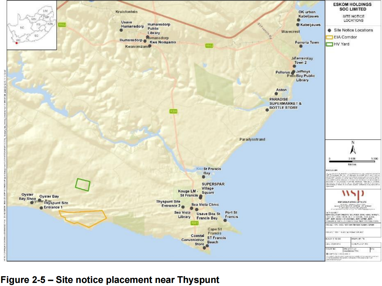
- The legally required chance for the public to comment. The steps the practitioner must follow to notify and involve the public, including site notices, advertisements, written notice to neighbours, and one or more comment periods, before the authority decides.
The area and what the specialists found
Thyspunt. The site is a coastal dune system between Oyster Bay and Cape St Francis. The screening tool rates it Very High sensitivity for agriculture, archaeology and cultural heritage, and plant species (p. 81). The terrestrial biodiversity specialist confirms Very High sensitivity, describing "an environmentally complex coastal system dominated by extensive dune landscapes... and an associated mosaic of seasonal wetlands... highly sensitive to disturbance and fragmentation" (p. 549). The site falls within Critical Biodiversity Areas 1 and 2, Ecological Support Area 1, a Strategic Water Source Area, and the Garden Route Key Biodiversity Area, which meets thresholds for three criteria of the Global Standard for Key Biodiversity Areas with 168 qualifying species (p. 357 to 358, p. 464 to 466). Ten plant species of conservation concern were recorded, and the protected tree Sideroxylon inerme occurs in relatively high numbers and would need a removal permit (p. 626, p. 763).
The dune specialist describes the Oyster Bay mobile headland bypass dunefields as "South Africa's last large, active examples of this type of dunefield" and "unique locally, regionally, and likely globally" (p. 407, p. 578). Transverse dunes move eastward at 15 to 20 m per year (p. 579). Groundwater surfaces between the dunes to form ponds and wetlands, and Oyster Bay village relies solely on groundwater for domestic supply (p. 407, p. 421).
In January 2025 SAHRA gazetted a notice provisionally protecting the Thyspunt site as a Grade I Cultural Landscape under section 29 of the National Heritage Resources Act (p. 14, p. 342, p. 772). That protection lapses on 1 February 2027 and may be renewed once (p. 772). The heritage specialist records that the entire project site lies "in areas of very high and high sensitivity... provisionally protected as a Grade I Cultural Landscape, and would be unable to be supported from a cultural landscape perspective" (p. 772). The report also states that "Resolving whether Thyspunt is, in fact, a cultural landscape of national significance is at the crux of the issue" (p. 15).
Offshore, Thyspunt has mainly sandy shores of Least Concern, with patches of Agulhas Stromatolite Mixed Shore, a Vulnerable habitat with a total national extent of only 8.45 km2 (p. 225 to 226, p. 286). The report says "every effort should be made to avoid direct disturbance to these habitats" (p. 286). Thyspunt overlaps productive chokka squid spawning and fishing grounds (p. 650 to 651).
Bantamsklip. The screening tool rates Bantamsklip Very High for animal species, aquatic biodiversity, civil aviation, defence, palaeontology and terrestrial biodiversity (p. 81). Part of the site overlaps the Groot Hagelkraal Private Nature Reserve and part of the Walker Bay Nature Reserve, sits within a Critical Biodiversity Area and the Agulhas Coast Key Biodiversity Area, and includes ecosystems listed as Endangered and, on the 2022 national list, Critically Endangered (p. 342, p. 357, p. 458 to 464). The report notes that "A legal process may be required to de-proclaim the protected area" (p. 629). Dyer Island, about 15 km west, supports Critically Endangered African Penguin colonies (p. 774 to 775).
Radiation and safety. The calculated annual dose to a member of the public is 0.171 mSv per year at Thyspunt and 0.129 mSv per year at Bantamsklip, against a national public limit of 1 mSv per year and a site constraint of 0.25 mSv per year, so the regulatory constraint is met on the report's figures (p. 437, p. 695). No reference organism exceeds the 10 microgray per hour screening value for non human biota (p. 437). Radiological safety, dose limits and the emergency planning zones sit with the National Nuclear Regulator rather than with DFFE, under a co-operative agreement between the two bodies, and DFFE "will not make a decision on the acceptability of radiological impacts" (p. 321 to 322, p. 390 to 391). The emergency planning zones for the new plant have not yet been determined (p. 158).
Impacts that remain high after mitigation. The report's own tables list a number of residual ratings that do not improve, or remain High or Very High, after mitigation. These include impacts on Critical Biodiversity Areas, High before and High after (p. 628); disruption of ecosystem processes, Very High to High (p. 629); loss of faunal habitat and direct mortality of fauna including species of conservation concern, Very High to High (p. 603 to 607); wetland loss at Thyspunt, Very High to High (p. 630 to 631); visual impact during operation, High before and High after at both sites (p. 715); loss of marine fishing grounds to exclusion zones, with "no practical mitigation possible" (p. 648, p. 651); the Thyspunt inland agricultural land, Moderate with no mitigation available (p. 602); and cumulative impacts on fauna and invertebrates, Very High before and Very High after (p. 754). Thermally elevated discharge water is rated Very High before mitigation, with the post mitigation entry shown as both Moderate and High (p. 644, p. 747).
Preferred site. Across 24 themes, the summary table records Thyspunt as preferred for marine physical, terrestrial biodiversity, marine ecology, socio economic, heritage, town planning, visual and climate change; Bantamsklip as preferred for air quality, dune geomorphology, agriculture, flora, aquatic ecosystems and noise; and the remainder neutral (p. 781). The recommendation to carry Thyspunt forward rests substantially on site readiness, the advanced Nuclear Installation Site Licence process, and transmission proximity to the Grassridge and Dedisa substations (p. 781 to 783).
Potential concerns and unresolved questions
1. Thyspunt heritage status not resolved
SAHRA provisionally protected the Thyspunt site as a Grade I Cultural Landscape under section 29 of the National Heritage Resources Act in January 2025, and that protection lapses on 1 February 2027 (report p. 342, p. 772). The heritage specialist records that the entire project site lies in areas of very high and high sensitivity and "would be unable to be supported from a cultural landscape perspective" (p. 772), while the report also states that "Resolving whether Thyspunt is, in fact, a cultural landscape of national significance is at the crux of the issue" (p. 15) and that the SAHRA nomination process "has not been concluded" (p. 812). The report adds that no motivation for the nomination is available on SAHRIS and that it is unclear how the nominated boundary was arrived at (p. 772).
You may wish to ask DFFE whether it will defer any decision on the preferred site until SAHRA has concluded the section 29 process, and ask that the outcome of that process and the reasoning behind the protected boundary be placed on public record.
Main reference to cite: Final Environmental Scoping Report, p. 772
2. Impacts that stay high after mitigation
The report's own impact tables record several residual ratings that do not improve with mitigation: impacts on Critical Biodiversity Areas remain High (p. 628), disruption of ecosystem processes remains High (p. 629), loss of faunal habitat and direct mortality of fauna including species of conservation concern remain High (p. 603 to 607), wetland loss at Thyspunt remains High (p. 630 to 631), visual impact during operation remains High at both sites (p. 715), and cumulative impacts on fauna and invertebrates remain Very High (p. 754). For Thyspunt the report states that "residual impacts are expected to remain of high significance after mitigation, due to sensitivity not being able to be avoided or mitigated effectively due to location on the coastal dunes" (p. 23). Despite this, the report's preliminary conclusion is that "there are no fatal flaws" and impacts "can preliminarily be mitigated to acceptable levels" (p. 228).
You may wish to ask the authority to explain how a preliminary finding of no fatal flaws is reconciled with the number of residual High and Very High ratings in the report's own tables, and to require that each such rating be individually justified in the Environmental Impact Assessment Report.
Main reference to cite: Final Environmental Scoping Report, p. 628
3. Cooling water temperature figures do not agree
The maximum increase in recirculated water temperature is given as "< 12 degrees C" on p. 7 and as "< 1.5 degrees C" on p. 54, and elsewhere the report describes a 12 degrees C rise between intake and discharge with recirculation at the intake limited to 1.5 degrees C (p. 175, p. 279). The once through flow rate is given as up to about 200 m3 per second on p. 7, as 243 200 litres per second on p. 175, and as 230 to 240 m3 per second on p. 279. Because the thermal plume, the intake velocity and the risk of recirculation all follow from these numbers, the marine and thermal assessments cannot be reproduced from the inputs as stated.
You may wish to ask that a single, corrected set of cooling water flow and temperature figures be published, and that the marine, thermal plume and recirculation modelling in the Environmental Impact Assessment Report be based explicitly on those corrected figures.
Main reference to cite: Final Environmental Scoping Report, p. 7 and p. 54
4. Thermal discharge falls outside the national guideline
The report states that the proposed once through cooling discharge with a 12 degrees C temperature rise "is not strictly accommodated within the existing guideline framework" of the 2014 National Guideline for Discharge of Effluent from Land based Sources into the Coastal Environment and "would therefore require motivation under the 'exceptional circumstances' clause" (p. 644, p. 645). DFFE commented that in the draft "no substantive justification or supporting analysis is provided" for such a motivation (p. 19). The water quality guidelines cited recommend that temperature variation not exceed 1 degree C at the edge of the mixing zone, or 10 percent above ambient in the more recent version (p. 645).
You may wish to ask that the full motivation for exceptional circumstances, with supporting thermal plume modelling validated against measurements, be published for public comment before the Environmental Impact Assessment Report is finalised.
Main reference to cite: Final Environmental Scoping Report, p. 644
5. Chokka squid fishery and offshore spoil disposal
Offshore disposal of excavated sediment is rated Very High significance for turbidity and smothering effects on chokka squid spawning at Thyspunt, reducible to Moderate if dumping occurs and Very Low if it does not, and the marine specialist states that "Preferably, alternative uses should be found for the excavated sediment, and it should not be disposed of offshore" (p. 638 to 639). Separately, the loss of access to nearshore fishing grounds through marine exclusion zones is rated with "no practical mitigation available to reduce this significance" (p. 18, p. 651). Roughly 6.5 million m3 of spoil requires disposal at Thyspunt (p. 281). A cut and fill alternative added after public comment would reduce excess spoil from 6.37 million m3 to 478 942 m3 (p. 281 to 282). The report also notes "inconsistencies between marine ecology and socio-economic impact ratings" for fishery impacts (p. 104).
You may wish to ask that the cut and fill and beneficial use alternatives be fully costed and assessed in the Environmental Impact Assessment Report, and that offshore disposal not be adopted as the preferred option until those alternatives have been shown to be unworkable.
Main reference to cite: Final Environmental Scoping Report, p. 638
6. Freshwater and wetland data gaps at Thyspunt
The freshwater specialist report "explicitly acknowledges that no new biophysical or water quality data were collected" and that detailed wetland delineation "has not been undertaken" (p. 20, p. 114 to 115). Thyspunt dunefield wetlands are mapped as "indicative layers only" because the dunes migrate (p. 114). DFFE queried the assignment of "reducible" or "low" post mitigation ratings to impacts on "highly sensitive and, in some cases, irreplaceable aquatic ecosystems" (p. 20). The specialist nonetheless proposes firm numerical setbacks, at least 220 m from Langefonteinvlei, at least 150 m from coastal seeps and at least 100 m from wetlands north of the dunefield, the last with implications for where the high voltage yard can go (p. 632 to 633). The specialist also records that "The ability of Eskom to adhere to [mitigation requirements] in a transparent and reliable manner is uncertain" (p. 765).
You may wish to ask that a full on the ground wetland delineation and at least one wet season and one dry season of water quality data be completed before the Environmental Impact Assessment Report is issued, and that the proposed setbacks be carried as enforceable conditions rather than recommendations.
Main reference to cite: Final Environmental Scoping Report, p. 20
7. Major components excluded from this application
Transmission lines and corridors, the staff village, external access roads and public road upgrades, off site construction camps, off site emergency and evacuation infrastructure, the water use licence and the coastal waters discharge permits all fall outside the battery limits of this application and would be dealt with in separate processes (p. 12, p. 169, p. 343). At Thyspunt the excluded transmission works are substantial: up to five 400 kV lines and two 765 kV lines totalling about 1 400 km (p. 198). The report records public comments alleging unlawful "project splitting" on this basis (p. 105). It also notes that the transmission heritage route at Thyspunt would need to cross "very highly sensitive and no-go dune field features" (p. 286) and that a new powerline through a declared national heritage site "will not be acceptable" if the Grade I declaration is finalised (p. 727).
You may wish to ask DFFE to state how the cumulative effects of the excluded components will be assessed and weighed in this decision, and whether the transmission route can be shown to be feasible before the generation facility is authorised.
Main reference to cite: Final Environmental Scoping Report, p. 169
8. Kouga buffer distance given as both 16 km and 550 m
The Kouga Spatial Development Framework of 2020 restricts institutional land uses such as hospitals, prisons and old age homes, and new food processing plants, within 16 km of the Thyspunt site, and requires monitoring of agricultural activity within that radius (p. 220, p. 365). The Draft Kouga Municipal Spatial Development Framework Review of 2024/2025 gives the same restrictions as applying within 550 m (p. 365 to 366). The report records this discrepancy but does not reconcile it (p. 220). The emergency planning zones for the new plant have separately not yet been determined and will be set by the National Nuclear Regulator (p. 158).
You may wish to ask which distance the authority regards as applicable, and request that the land use restriction radius around the site be settled and published before any authorisation, together with the emergency planning zone boundaries.
Main reference to cite: Final Environmental Scoping Report, p. 220
9. Single visit and single season surveys
The avifaunal assessment is based on a single site visit in the dry season with "no temporal trend data" and is described as scoping and site sensitivity verification level only, not a comprehensive specialist study (p. 116 to 117). The terrestrial invertebrate and fauna assessment is based on a single wet season visit (p. 117). Terrestrial biodiversity field surveys were "limited in spatial and temporal extent" and intended as "high-level baseline and sensitivity screening", with seasonally representative and targeted species of conservation concern surveys "not yet been fully exhausted" (p. 22, p. 115 to 116). The marine biology study collected no additional in situ data (p. 117). The invertebrate specialist states that "a return to the site is essential for conducting more thorough surveys" (p. 804). Despite this, a site preference recommendation has been made.
You may wish to ask that multi season surveys, including targeted searches for species of conservation concern, be completed and published before the preferred site is confirmed, and ask on what basis a single season dataset can support a siting decision.
Main reference to cite: Final Environmental Scoping Report, p. 116
10. Bantamsklip evidence is dated where Thyspunt evidence is current
The hydrology and geohydrology data for Thyspunt are updated to 2025, while the Bantamsklip data were "last updated 2014" and are described as "sufficiently characterised" (p. 112, p. 114). The freshwater supply dataset for Bantamsklip covers only 2008 to 2014 but is "considered to be adequate" (p. 112). Bantamsklip surface water data come from the 2014 environmental impact report and do not incorporate climate change, which "must be included in updated hydrological and hydraulic modelling if this site is advanced" (p. 758 to 759). More recent meteorological data exist for Thyspunt but not for Bantamsklip, where the weather station was decommissioned (p. 125). Construction traffic estimates for both sites rest on Eskom documents from June 2010 (p. 122).
You may wish to ask whether a comparison between two sites can be considered even handed when the evidence base for one is a decade older than the other, and request that this asymmetry be stated openly in the reasons for the site recommendation.
Main reference to cite: Final Environmental Scoping Report, p. 112
11. Noise conclusion drawn without baseline monitoring
The scoping report concludes that Bantamsklip is the preferred site from an acoustic perspective, but DFFE notes that this conclusion is "of limited confidence" because it is "derived without baseline noise monitoring", and the practitioner confirms that site sensitivity was classified "based solely on the distance of nearest receptors" (p. 25). Sensitive receptors were identified from desktop Google Earth imagery and the construction phase assessment is qualitative only (p. 121). At Thyspunt 16 sensitive receptors are identified, many directly on the site boundary, with acoustic impacts rated "very high" to "high" in one summary (p. 677 to 678) and site sensitivity "medium" with impacts "moderate" in another (p. 772 to 773). The report also notes that eight Thyspunt receptors are residences on Eskom leased land whose leases would be terminated before construction (p. 678, p. 773).
You may wish to ask that measured baseline noise monitoring at identified receptors be completed for the Environmental Impact Assessment Report, and that the differing summaries of Thyspunt noise sensitivity be reconciled.
Main reference to cite: Final Environmental Scoping Report, p. 25
12. Marine baseline relies on secondary information
DFFE flagged that the marine ecology report is "constrained by reliance on secondary information, limited site-specific baseline data, and insufficient quantitative assessment of key impact pathways", and that impact ratings and site comparisons are "not adequately supported by empirical evidence" (p. 19). The hydrodynamic, sediment dispersion, entrainment and impingement, noise and thermal plume modelling studies are described as "being undertaken" rather than complete (p. 19 to 20). At Bantamsklip an extreme value analysis of currents "has yet to be conducted" because of the short data record, and at Thyspunt the equivalent analysis carries a "high degree of uncertainty" (p. 424, p. 432).
You may wish to ask that the completed marine modelling studies be released for public review as standalone documents when they are finished, rather than only summarised in the Environmental Impact Assessment Report.
Main reference to cite: Final Environmental Scoping Report, p. 19
13. Tsunami hazard analysis outstanding
The report assumes that tsunamis caused by volcanic flank collapse, nearly 10 m higher than long waves, will govern the design, and states that this assumption requires "verification... following a site-specific tsunami hazard analysis (THA)" that has not been done (p. 424, p. 432, p. 797). Modelled worst case water levels reach 11.03 m above mean sea level at Bantamsklip and 14.77 m at Thyspunt, with the plan of study noting "indicated higher risks for Thyspunt" (p. 596, p. 759 to 760, p. 797). The report also records that tsunami drawdown to minus 6.10 m at Thyspunt against a proposed stilling basin elevation of minus 8.29 m "leaves little buffer" (p. 596).
You may wish to ask that the site specific tsunami hazard analysis, and any independent verification of it under IAEA guidance, be completed and published before the preferred site is confirmed.
Main reference to cite: Final Environmental Scoping Report, p. 797
14. Biodiversity offset strategy deferred
The report confirms that "The requirement for a biodiversity offset has been confirmed" and that the Biodiversity Offset Strategy "will be included in the Draft EIAr" (p. 341 to 342). The report's own methodology states that where residual impacts of Moderate or higher significance remain, "biodiversity offsets/compensation must be provided" (p. 825), and that Very High residual impacts "constitute a fatal flaw" for which "compensation or offsets would not be feasible" (p. 824). At present the offset discussion is at a high level and in places rests on assumptions of "future planning flexibility (e.g. reconfiguration of layouts, establishment of offsets, or protected area deproclamation)" (p. 21). Impacts on Critical Biodiversity Areas remain High after mitigation, with the note that "Offsets may be required to locate alternative sites to include in the CBA network" (p. 628).
You may wish to ask that the Biodiversity Offset Strategy, including the ratios, the receiving land and who would fund and manage it in perpetuity, be published for public comment rather than appearing for the first time in the Draft Environmental Impact Assessment Report.
Main reference to cite: Final Environmental Scoping Report, p. 341
15. No final layout maps
The report states that no detailed or final layout maps are yet available and that these are deferred to the Draft Environmental Impact Assessment Report, where the development area, final infrastructure positions, sensitive features, buffers and no go areas will be shown (p. 15 to 16). The terrestrial assessment was "undertaken using a preliminary development envelope" which limited the resolution of impact quantification (p. 22), and habitat condition was characterised at "broad to intermediate scale" rather than fine scale for all infrastructure (p. 22). For Thyspunt hydrology the report notes that "The exact, localised position of the illustrative nuclear island footprint remains undetermined" (p. 414). The buildable area is also described as "far in excess of the actual NPP footprint" (p. 171).
You may wish to ask when the layout maps showing the actual footprint, buffers and no go areas will be released, and request that the public be given a genuine opportunity to comment on them once they exist.
Main reference to cite: Final Environmental Scoping Report, p. 15
16. Spoil and other quantities differ between sections
The Bantamsklip rock stockpile volume is given as 1 198 591 m3 on p. 9 and as 198 591 m3 on p. 55, and the same table elsewhere lists 10 073 273 m3 alongside 1 198 591 m3 (p. 188). Fuel enrichment is printed as "45% - Conventional PWR / 20% - SMR" (p. 182), which does not match the 4.95 percent normally associated with conventional pressurised water reactors. The Bantamsklip transmission requirement is given as about 1 000 km on p. 199 and as about 2 211 km on p. 244. Public dose figures on p. 162 are stated in units that appear inconsistent with the 1 mSv per year limit given elsewhere. The report elsewhere confirms that an inconsistency between two of its own specialist preference tables had to be corrected after public review (p. 242).
You may wish to ask for an errata sheet reconciling these figures, and ask which values were actually used as inputs to the specialist assessments.
Main reference to cite: Final Environmental Scoping Report, p. 9 and p. 55
17. Loss of irrigated pasture at the inland Thyspunt site
The agricultural specialist finds that the coastal parts of both sites are unsuitable as cropland, but that the Thyspunt inland site "is considered to be above the threshold for needing to be conserved as agricultural production land because of its suitability for irrigated pastureland", and that development "will result in the permanent loss of this land to agriculture... in terms of national food security". The impact is rated Moderate at Thyspunt with no mitigation available for the occupation of that land (p. 602). The area involved is given as less than 36 hectares (p. 760 to 761). The surrounding 20 km radius is about 65 percent commercial dairy farming (p. 400).
You may wish to ask that the exact area of irrigated pasture to be lost be quantified and mapped in the Environmental Impact Assessment Report, and ask whether the substation and high voltage yard can be sited to avoid it.
Main reference to cite: Final Environmental Scoping Report, p. 602
18. High level waste has no disposal endpoint
The report states that a "high-level radioactive waste disposal programme has not yet been implemented in South Africa" (p. 102 to 103), that used fuel would be stored on site "for a period of approximately 60 years, as is currently practised at... Koeberg" (p. 122), and that dry storage would have an 80 year capacity across 12.14 ha (p. 182). The plan of study notes that "Historically, HLW endpoint planning has not received sufficient prominence in nuclear power decision-making" and that developing a disposal programme "may take several decades" (p. 820). The report also records that the Radioactive Waste and Transport Assessment "will not include quantitative dose or risk assessments for releases to the environment" at the sites, during transport, or at Vaalputs, as those fall under the National Nuclear Regulator process (p. 17), and that the National Environmental Management: Waste Act does not cover radioactive waste (p. 12, p. 340).
You may wish to ask how the long term storage of used fuel on a mobile coastal dune site, and the absence of a national disposal endpoint, will be weighed in the environmental decision given that the quantitative dose assessment sits with a different regulator.
Main reference to cite: Final Environmental Scoping Report, p. 820
19. Overlap between the environmental and nuclear licensing processes
The report acknowledges a "risk of duplication between the S&EIR and NNR licensing processes" (p. 64), and records that DFFE "will not make a decision on the acceptability of radiological impacts" under the co-operative agreement with the National Nuclear Regulator (p. 321 to 322). The Nuclear Installation Site Licence application for Thyspunt is still under review with "no stipulated timelines", and a response is anticipated only in the last quarter of 2026 (p. 11 to 12). Emergency planning zones will be set by the National Nuclear Regulator and are not yet determined (p. 158). The report also notes that comparative impact rating between the two sites is "not feasible" for the radioactive waste topic (p. 124 to 125).
You may wish to ask DFFE to set out clearly which radiological and nuclear safety questions it will and will not consider in its decision, and where and when members of the public can raise the questions it will not consider.
Main reference to cite: Final Environmental Scoping Report, p. 64
20. Cumulative impacts largely deferred
DFFE required cumulative impacts to be clearly defined and quantified, with a process flow showing how other developments' data informed the assessment, and a "cumulative impact environmental statement on whether the proposed development must proceed" (p. 29). The practitioner commits that cumulative impacts "will be comprehensively refined during the EIA phase" (p. 29). At present 25 approved renewable energy projects and one pending lie within 50 km of Thyspunt (p. 723), cumulative fauna and invertebrate impacts are rated Very High both before and after mitigation (p. 754), cumulative socio economic impacts "could not be assessed in detail due to limited information" (p. 726), and the report notes that public requests for information on other projects received "no response... to date" (p. 722).
You may wish to ask that the cumulative assessment quantify the total area of transformed habitat and the combined powerline network in the area, and that the required cumulative impact environmental statement be published for comment.
Main reference to cite: Final Environmental Scoping Report, p. 29
21. Several listed activities still marked unconfirmed
A number of activities under Listing Notice 3 are recorded with applicability "yet to be confirmed", including bulk water reservoirs over 250 m3, telecommunication masts over 15 m, roads wider than 4 m, dangerous goods storage of 30 to 80 m3, clearance of 300 m2 or more of indigenous vegetation in Critical Biodiversity Areas, structures within watercourses or coastal setbacks, and transformation of conservation zoned land (p. 333 to 339). The capacity of the sewage treatment facility, the capacity of dangerous goods storage and the road design specifications are all to be "confirmed during the design phase" (p. 332). Whether a waste management licence and an atmospheric emission licence are required is also to be confirmed (p. 340, p. 349).
You may wish to ask that the full and final list of listed activities be confirmed and advertised before the Environmental Impact Assessment Report is finalised, so that the public knows exactly what is being applied for.
Main reference to cite: Final Environmental Scoping Report, p. 333
22. Questions raised about the practitioner's independence
The report records that concerns about "EAP Independence & Conflict of Interest" were raised with High prevalence during the scoping comment period, specifically regarding WSP's corporate association with the global nuclear industry, alleged bias, EAPASA registration, and requests for an independent practitioner or peer reviewers nominated by DFFE (p. 103). The report also records that the competent authority, at the pre-application meeting, "would not require additional specialist input" to decide on the application (p. 111). Peer review is provided for in the plan of study, but the required letter from a peer reviewer must indicate "professional support for the preferred alternative identified in the EIA Report" (p. 822).
You may wish to ask DFFE how it will satisfy itself as to the independence of the assessment, and whether peer reviewers can be appointed on terms that do not require them to support a preferred alternative in advance.
Main reference to cite: Final Environmental Scoping Report, p. 103
23. Project classification described inconsistently
The report states that the project is classified as an IFC Category A project, meaning potential for significant adverse environmental and social impacts, but the accompanying description reads "having the potential to cause limited adverse environmental or social risks and/or impacts that are few, generally site specific, largely reversible, and readily addressed through mitigation measures" (p. 373). Elsewhere the report classifies the project as Category A under the Equator Principles as "a project with by significant potential adverse environmental and social impacts" (p. 383). The report also states that IFC Performance Standard 5 on land acquisition and resettlement "is not applicable" because the land is Eskom owned (p. 379), while noting that eight residences at Thyspunt are leased to outside parties whose leases would be terminated before construction (p. 678).
You may wish to ask for the classification wording to be corrected, and ask what arrangements are proposed for the households currently occupying Eskom leased residences at Thyspunt.
Main reference to cite: Final Environmental Scoping Report, p. 373
Mitigation and biodiversity offset
A ShapeSFB summary of how the report proposes to manage impacts, following the mitigation hierarchy. This helps distinguish genuine legal and ecological measures from generic promises. Tap a heading to read the detail.
1. Residual impact rating (after mitigation)
Mixed by discipline. Key residual ratings after mitigation include: terrestrial biodiversity impacts on Critical Biodiversity Areas remain "High" and disruption of ecosystem processes remains "High" (p. 628, p. 629); impacts on protected areas at Bantamsklip remain "High" (p. 629); loss of habitat, direct mortality of fauna and Species of Conservation Concern, and disruption of ecological life cycles remain "High" (p. 603, p. 604, p. 608, p. 609); invertebrate habitat loss remains "High" (specialist opinion overriding a methodology result of "Very High", p. 610); wetland loss and degradation at Thyspunt remains "High" while Bantamsklip reduces to "Moderate" (p. 630, p. 631); thermally elevated discharge water remains "Moderate" to "High" (p. 644); chokka squid fishery exclusion zone impacts remain "High" at Thyspunt and "Moderate" at Bantamsklip with "no practical mitigation possible" (p. 18, p. 641, p. 651); visual impact during operation remains "High" at both sites (p. 228, p. 715); cultural landscape impacts remain "High" at Bantamsklip and "Moderate" at Thyspunt (p. 701, p. 702, p. 703); construction worker presence and job seeker influx remain "High" (p. 666, p. 671); radioactive waste and transport remains "Moderate" (p. 720, p. 721); cumulative fauna and invertebrate impacts remain "Very High" and cumulative terrestrial impacts remain "Moderate" with no improvement after mitigation (p. 754). For Thyspunt overall, "residual impacts are expected to remain of high significance after mitigation, due to sensitivity not being able to be avoided or mitigated effectively due to location on the coastal dunes" (p. 23, p. 223, p. 225).
2. Biodiversity offset considered
Yes
3. Proposed monitoring and enforcement
- Eskom is responsible for EMPr implementation, independently monitored by an Environmental Control Officer (p. 392, p. 393)
- ECO supervision of transmission line construction across the Thyspunt mobile dunefield (p. 579, p. 580)
- Quarterly groundwater monitoring for hydrocarbon, organic and bacterial contamination, with housekeeping and an emergency response plan (p. 583)
- Tritium monitoring at site and regional level to detect radionuclide release (p. 583)
- Test pumping and numerical modelling to confirm aquifer drawdown, and confirmation of the dewatering draw-down radius (p. 582, p. 583, p. 630, p. 631)
- Monitoring of dune movement and use of brushwood and drift fences in response to climate change driven sand transport (p. 581, p. 582)
- Weekly tortoise collision monitoring on operational roads (p. 620)
- Rehabilitation plan reviewed every 3 years and monitoring annually for 5 years after closure for fauna habitat (p. 625, p. 626)
- Avifauna monitoring annually for 3 years after decommissioning (p. 663, p. 664)
- Long-term monitoring and adaptive management for fishery exclusion zone impacts, described as the only available response given no practical mitigation (p. 686, p. 687)
- Comprehensive long-term ecological study across the entire ecosystem if the project is approved, to address disruption of ecosystem processes (p. 629)
- Reserve Management Plan with ring fenced maintenance funding for the areas declared as formal Nature Reserve in perpetuity (p. 630, p. 631, p. 635, p. 636)
- Dust Management Plan under the November 2013 dust control regulations to be included in the EMPr (p. 349)
- Alien and Invasive Species Management Plan and mandatory biosecurity and invasive species programme (p. 340, p. 347, p. 725)
- Chance Find Procedure and Chance Fossil Finds Procedure to be included in the EMPr (p. 381, p. 709, p. 712)
- Community Liaison Officer appointed under the EMPr for ongoing communication, plus a Grievance Mechanism and Stakeholder Engagement Plan maintained as living documents through construction and operation (p. 384, p. 385, p. 390, p. 391, p. 392, p. 667)
- Emissions reporting required during the operational phase, with an Atmospheric Emission Licence if diesel storage exceeds 1 000 m3 (p. 349)
- Radiological monitoring, radiation protection and access control on site, with NNR setting dose limits and the plant not being approved if limits are not met (p. 166, p. 652, p. 653)
- Habits data for representative person dose assessment to be repeated at regular intervals, for example every 5 years, once the site is selected (p. 124)
- Peer review of specialist reports required, with a formal letter from the peer reviewer confirming review and professional support for the preferred alternative, and independent peer review of the probabilistic seismic hazard analysis for each site (p. 801, pp. 821 to 822)
- Independent Review and Independent Monitoring under Equator Principles 7 and 9 to become applicable if the project is developed (p. 385)
- Financial provision for decommissioning and rehabilitation under NEMA section 24P and National Nuclear Regulator Act sections 26A and 29 to 35 (p. 339, p. 340, pp. 319 to 321)
4. Impact avoidance
- Apply a strict mitigation hierarchy with strong emphasis on avoidance and footprint discipline, followed by minimisation, rehabilitation and restoration, and offsets where residual impacts remain (p. 389, p. 393, p. 763)
- Refined mapping and micro-siting to demonstrate avoidance of high Sensitivity Ecological Importance areas and functional ecological corridors (p. 23, p. 808)
- Declare all areas other than the footprint and existing surface infrastructure as no-go areas to vehicles (p. 284)
- Restrict the development footprint and avoid wetlands, freshwater seeps, mobile dunes, dense thicket and dune forest, maintaining ecological corridors and coastal to inland linkages (p. 284, p. 626)
- Treat all watercourses and stipulated buffer areas at both sites as no-go areas (p. 285)
- At Bantamsklip, establish the area north of the R43 as a no-go area for all NPP associated activities except alien plant clearing and management (p. 285, p. 630)
- Avoid direct disturbance to the Agulhas Stromatolite Mixed Shore at Thyspunt (Vulnerable habitat, national extent only 8.45 km2) by designing the construction footprint around it and preferring Least Concern habitats for development (p. 286)
- Cormorant breeding areas are no-go during the breeding season August to December, with blasting avoided in that period (p. 286, p. 653, p. 657)
- Thyspunt setbacks: at least 220 m from the Langefonteinvlei wetland, at least 150 m from the upstream edge of all coastal seeps, at least 100 m from all wetlands north of the Oyster Bay dunefield, and at least 50 m from wetlands for access roads (p. 631, p. 632, p. 633)
- Access roads at Thyspunt must not cross through the high dunes containing Langefonteinvlei, and no development should extend north beyond the southern toe of the high dune forming the southern boundary of Langefonteinvlei (p. 631, p. 633)
- Locate the NPP platform as far east as possible at Thyspunt to reduce impact on coastal seeps (p. 634)
- Site marine intake away from sensitive habitat, avoiding the upper and lower 1 m of the water column (p. 643, p. 647)
- Site infrastructure landward of erosion and flood lines to address long-term coastline recession (p. 590)
- Grade IIIA coastal no-development buffer at both sites, with an additional Grade IIIB inland dune buffer at Thyspunt (p. 345, p. 705)
- Preferably find alternative uses for excavated sediment rather than offshore disposal, to avoid smothering chokka squid spawning grounds at Thyspunt (p. 638, p. 766)
- Cut and fill alternative added in response to stakeholder concerns, reducing excess spoil at Thyspunt from 6.37 million m3 to 478 942 m3 with the remainder reused in the HV yard (p. 281, p. 282)
5. Impact minimisation
- Dust control by water sprays, chemical suppressants, paving of roads and covering of stockpiles during construction and decommissioning (p. 574, p. 577)
- Best practice engineering, a leak detection and repair programme and paved roads to reduce operational air emissions (p. 575, p. 576)
- Transmission towers across the Thyspunt mobile dunefield limited to a maximum 400 m span, with helicopter access during construction to avoid permanent roads, under ECO supervision (p. 579, p. 580)
- Install a cut-off wall to limit aquifer depletion from footprint dewatering and to limit groundwater contamination (p. 582, p. 583)
- Stormwater management plan with attenuation, erosion protection and silt traps, and clean and dirty water separation (p. 585, p. 586)
- Dispose of construction brine 500 m offshore beyond the surf zone and blend brine with cooling water effluent during operation (p. 283, p. 584)
- Extend the desalination outfall offshore and use energy dissipating design to limit elevated surf zone salinity (p. 592)
- Design cooling water intake and outfall so that recirculation raises intake temperature by no more than 1.5 degrees C above ambient (p. 279, p. 594)
- Minimise total residual oxidant concentrations through the biocide dosing regime (p. 279)
- Intake velocity of 0.15 m/s or less using footer valves and horizontal extraction to limit entrainment and impingement (p. 643, p. 647)
- Lighting Management Plan using low pressure sodium or monochrome orange LED lighting, with no white LED, mercury vapour or halogen lighting, to limit invertebrate light pollution (p. 615, p. 616, p. 617, p. 618)
- Speed limits of 30 km/h for fauna protection and 40 km/h for avifauna, with a Construction Traffic Management Plan (p. 620, p. 661, p. 689)
- Anti-perch devices, UV reflective markers and fencing specifications with the top two strands smooth wire and a minimum 30 cm between wires to reduce bird collisions, and a noise threshold of below 55 dB(A) at sensitive habitat boundaries (p. 660, p. 661)
- Pipe or line the seawater outlet channel at Thyspunt to prevent saltwater contamination of coastal seeps, and prohibit use of seawater for dust suppression outside the NPP footprint (p. 634, p. 635)
- Faunal underpasses under the R43 at Bantamsklip, especially at the Haelkraal River crossing, and permeable fencing and fauna crossings for connectivity (p. 630, p. 631, p. 725)
- Avoid high turbidity activities during peak chokka squid spawning, October to March along the Eastern Cape coast (p. 638, p. 639)
- Secondary containment, leak detection, spill kits, designated repair areas and emergency response plans for hydrocarbon and hazardous substance spills (p. 597, p. 598, p. 599, p. 583)
- Design to peak ground acceleration and seismic zone compliance, with fault assessment and seismological investigation as design input (p. 598, p. 600)
- Workforce Management Plan, local hiring priority, managed accommodation, prohibition of recruitment at the gate, Worker Code of Conduct, GBV, SEA and SH training, Community Liaison Officers and a Grievance Mechanism (p. 666, p. 667, p. 668)
- Mandatory biosecurity and invasive species programme, alien invasive plant control and fire management alignment (p. 285, p. 725)
- Nest walkdown required before vegetation clearance (p. 658, p. 659)
- Noise modelling, setbacks and noise barriers or enclosures for marine and terrestrial noise (p. 646)
6. Rehabilitation
- Rehabilitate disturbed areas with indigenous species and restrict the development footprint (p. 284)
- Rehabilitation, berms, drainage control and dust suppression to address soil erosion from site clearing (p. 599)
- Rehabilitation of the surf zone after construction of pipelines and services (p. 584)
- Rehabilitation of the nuclear site footprint at decommissioning, including environmental remediation, property release and licence termination (p. 169, p. 560)
- Rehabilitation plan for decommissioning reviewed every 3 years, with monitoring annually for 5 years post closure (p. 625, p. 626)
- At Bantamsklip, dune geomorphology specialist considers the NPP practical to construct with minimal operational impact post rehabilitation (p. 406, p. 407)
- Declaration of areas outside access roads, the NPP platform and the HV yard as a formal Nature Reserve in perpetuity, excluding agriculture, mining and windfarm expansion, with a Reserve Management Plan and ring fenced maintenance funding (p. 630, p. 631, p. 635, p. 636)
- Remainder of the chosen site proposed to be managed as a private nature reserve (p. 388, p. 393)
- Engineered coastal protection and siting to address long-term coastline recession (p. 590)
7. EAP's reason
The EAP concludes at scoping level that "there are no fatal flaws associated with the proposed NPP" and that "negative environmental impacts... can preliminarily be mitigated to acceptable levels", subject to further investigation in the EIA phase (p. 228). No unacceptable cumulative impacts and no unacceptable opportunity costs were identified at this stage (p. 228). For the recommended Thyspunt site, the EAP states that "specialist screening undertaken to date has not identified any unmitigable environmental constraints at Thyspunt" (p. 783). The EAP notes that the site is owned by Eskom, is appropriately zoned and safeguarded for nuclear development, is already reflected in the Kouga Spatial Development Framework, and that the NPP footprint will be limited with the remainder of the site remaining conserved as a Critical Biodiversity Area and proposed to be managed as a private nature reserve (p. 225, p. 388, p. 393, p. 783). The EAP also relies on need and desirability grounds, namely alignment with IRP 2025 which provides for 5 200 MW of new nuclear capacity by 2039, reduced coal reliance and greenhouse gas emissions, and grid resilience benefits (p. 224, p. 283, p. 284, p. 783). The EAP emphasises that the scoping mitigation measures "are preliminary mitigation measures suggested at this stage. They do not constitute final recommendations" and that impacts, cumulative impacts and offsets will be comprehensively refined during the EIA phase (p. 29, p. 557).
8. Page references
Mitigation hierarchy and significance implications: pp. 86 to 90, pp. 822 to 826, p. 389, p. 393. Biodiversity offset: p. 21, p. 23, p. 285, p. 341, p. 342, p. 379, p. 380, pp. 802 to 803, p. 806, p. 825, p. 826. Preliminary mitigation tables by discipline: pp. 574 to 644 and pp. 645 to 727. Impact significance screening summary: pp. 735 to 754. Residual high significance at Thyspunt: p. 23, p. 223, p. 225. EAP acceptability conclusions: p. 228, p. 783. Monitoring and EMPr commitments: p. 340, p. 346, p. 349, p. 381, p. 386, p. 392, p. 393, p. 583, p. 620, p. 626, p. 663, p. 664.
Your role
Scoping is the stage at which the public helps decide what the full Environmental Impact Assessment must investigate. Comments made now can change the terms of reference for the specialist studies, the alternatives that are carried forward, and the conditions the authority may later attach to any authorisation.
Comments carry more weight when they are specific. Where you can, quote the page or section of the report you are responding to, say plainly what the problem or question is, and say what you would like the authority to do about it: ask for a study to be done, ask for a figure to be reconciled, ask for a buffer or a condition, or ask for information to be released.
The report states that a further 30 day public comment period will be allowed on the Draft Environmental Impact Assessment Report, and that a request to extend that period will be submitted to DFFE (p. 828). If you want to be notified of that stage and of the eventual decision, ask to be registered as an interested and affected party.
ShapeSFB does not take a position for or against this proposal. If you submit through ShapeSFB, your comment is forwarded to the recipient listed below, and a copy is kept on record. You may also submit directly.
Documents received
Official documents received from the EAP or the competent authority. Every project shows at least the public notice and the principal assessment or application document, where both have been received.
Stay informed
The public comment period for this application has closed.
Want to be told when the next comment period opens, or when a new application is published for the Greater St Francis area? Join the notification list.
Get notifiedKnow someone this affects? Share it so they can take part too.