
These are the main issues in the draft programme and its coastal management line appendix, summarised in plain language from the two documents so you can decide what, if anything, you want to say. The page references show where each issue appears. This is a ShapeSFB summary, not the official document.
Kouga Local Municipality 2nd Generation Coastal Management Programme
Closes 28 September 2026 (SAST) · Municipal Coastal Management Programme review and Coastal Management Line development under ICMA Act 24 of 2008, sections 46(1)(b) and 25. No reference number stated in the documents.
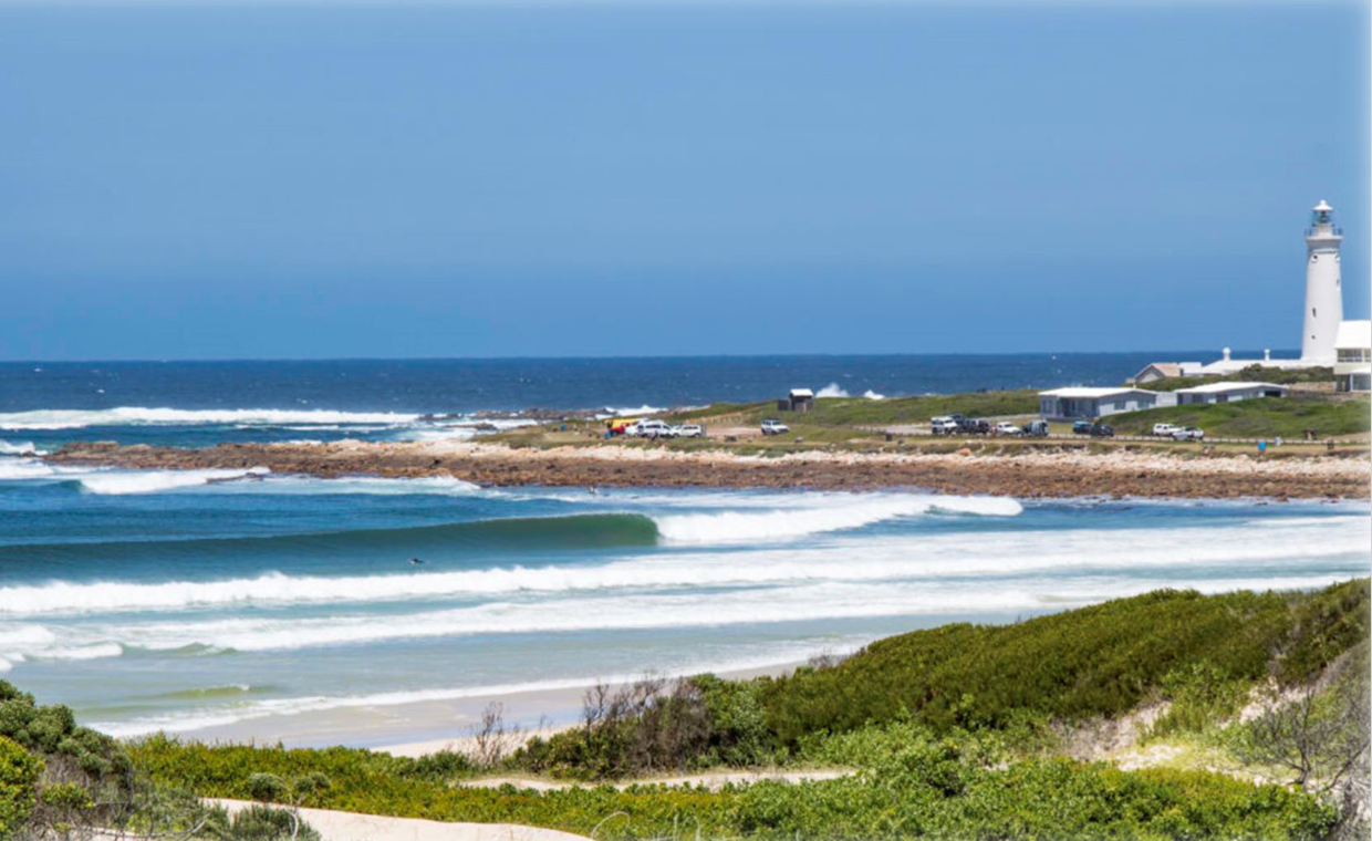
The plain-language summary and the potential concerns on this page are prepared by ShapeSFB from the official documents. They are summaries, not official documents. The source documents are listed under Documents received below.
In short
- Kouga Municipality is updating its five year Coastal Management Programme and developing a coastal management line for the coastline.
- A coastal management line can limit development on private coastal property, but the line in this draft is not yet legally established and no map or list of affected properties has been released.
- The plan's evidence base predates the major May 2026 storm, which it does not mention.
- Several legal requirements, key maps and cost details are missing or inconsistent.
- Anyone in the Kouga area can comment, before the closing date of 9 September 2026.
What is being proposed?
Kouga Local Municipality has released two draft documents for public comment. The first is the municipality's Second Generation Coastal Management Programme, dated June 2026 (report p. 1, p. 3). This is a policy and planning document, not an application to build anything. It sets out how the municipality intends to manage its coastline over the coming years. The second is a technical method for drawing a Coastal Management Line, or CML, for the Kouga coast from Jeffreys Bay to Cape St Francis and the Gamtoos River mouth (Appendix A, p. 1).
The Coastal Management Programme is required by the National Environmental Management: Integrated Coastal Management Act 24 of 2008, usually called ICMA. Section 48 of that Act says a municipal coastal programme must be reviewed at least every five years (report p. 18). Kouga's first coastal programme formed part of the Sarah Baartman District Municipality programme adopted in 2019, so this is Kouga's first stand alone programme (report p. 9, p. 18). The public notice says the review is being done under sections 46(1)(b) and 25 of ICMA, and that it will bring in Operation Phakisa, District Development Programmes and the new National Climate Change Act 22 of 2024 (notice p. 1).
The programme is built around seven priority themes: compliance and enforcement, estuary management, coastal spatial planning and climate change adaptation, pollution and waste, public access, research and monitoring, and education and community stewardship (report p. 10, p. 21 to 22). It proposes annual implementation reporting and a review at least every five years (report p. 10).
The Coastal Management Line is the part most likely to affect individual properties. A CML is a line set under section 25 of ICMA. Once the provincial MEC for environmental affairs gazettes it, the municipality must show it on the maps that form part of its zoning scheme, and the MEC may make regulations restricting or prohibiting structures on the seaward side of it (Appendix A, p. 9). The line has not yet been finalised for Kouga (report p. 40 to 41). The method document explains how it was modelled, using tide levels, storm surge, wave setup, sea level rise and measured shoreline movement, with a further horizontal safety buffer of 10 m to 30 m in sandy areas such as the St Francis Bay spit and the Jeffreys Bay beachfront (Appendix A, p. 42 to 45).
The stated reason for the work is what the method document calls escalating vulnerabilities driven by intense coastal erosion, severe weather events and sea level rise (Appendix A, p. 1). A clear public benefit of the exercise, if it is completed and adopted, is that it would give residents, the municipality and future buyers a single mapped picture of coastal flood and erosion risk, and would provide a legal basis for managing building near the shoreline.
Written comments may be sent from 11 August 2026 until 9 September 2026 (notice p. 1, p. 2). Four public meetings are listed: 24 August 2026 at Aston Bay Hall, 25 August 2026 at Newton Hall, 26 August 2026 at St Francis Links, and a fourth meeting on 27 August 2026 at a venue described in the notice as "Link to be advertised" (notice p. 1).
Key terms in this application
Plain-language explanations of technical terms used here. See the full glossary.
- ECBCP
- Eastern Cape Biodiversity Conservation Plan. A provincial spatial biodiversity plan that maps the Eastern Cape by how important each area is for conserving ecosystems and ecological processes. It is a decision-support tool used by authorities and practitioners to judge whether a proposed land use is appropriate where it is proposed.
- EIA (Environmental Impact Assessment)
- The fuller assessment process for higher-impact activities. The more detailed assessment process (Scoping and Environmental Impact Reporting) used for larger or higher-impact activities. It usually runs in phases with more than one public comment period.
- Public participation process (PPP)
- The legally required chance for the public to comment. The steps the practitioner must follow to notify and involve the public, including site notices, advertisements, written notice to neighbours, and one or more comment periods, before the authority decides.
The coastline the plan covers
The programme describes the Kouga coastal zone as running from the Van Stadens River to the Tsitsikamma River (report p. 25). The executive summary of the same document instead describes the coastline as running from the Gamtoos River Mouth to Oyster Bay (report p. 9). The main coastal settlements listed are Jeffreys Bay, St Francis Bay, Cape St Francis, Oyster Bay, Paradise Beach, Aston Bay and Pellsrus (report p. 25, p. 33).
Under ICMA, the coastal protection zone covers the littoral active zone, rural land within 1,000 m of the high water mark, urban land within 100 m of the high water mark, and land vulnerable to a 1 in 50 year flood or storm event (report p. 24).
Estuaries
The programme rates each estuary using the National Biodiversity Assessment 2025. "Present Ecological State" is a health score from A, near natural, down to E or F, badly modified. "Recommended Ecological Category" is the state the estuary should be managed towards (report p. 25 to 27).
The Kromme is permanently open, is rated D, is of high biodiversity importance because of its Zostera capensis seagrass beds, and is under very high flow and pollution pressure, with high habitat loss, high fishing effort and high invasive alien fish. The report notes that marina development altered the natural mouth (report p. 26).
The Seekoei is rated D to E with a recommended category of D, is of high importance, and carries high flow and pollution pressure and very high habitat loss pressure. The causeway is recorded as having affected intertidal salt marsh (report p. 26).
The Gamtoos is rated B to C, is of high importance and is an Important Bird Area, but the report states that nearly 90 percent of the salt marsh at Gamtoos has been lost to vegetable cultivation and cattle grazing, and that almost the entire catchment has been converted to agriculture and cattle farms (report p. 26). The Slang estuary is rated C to D with very high pollution pressure (report p. 26). The Tsitsikamma, Kabeljous and Van Stadens estuaries are rated B, C and B respectively (report p. 25 to 27).
On estuary plans, the Gamtoos draft management plan of 2008 was never finalised or adopted (report p. 27 to 28). The Seekoei plan was developed in 2018 and updated in 2024, but the report says the extent of implementation and monitoring is not clearly documented (report p. 27). The Kromme has an Activity Zone Map from the Kromme River Joint Committee but not a comprehensive estuary management plan aligned with the National Estuarine Management Protocol (report p. 29). The other estuaries have no formally adopted plans (report p. 29).
Protected areas and biodiversity
There are 13 formally gazetted terrestrial reserves under the Protected Areas Act in the municipality, plus the Rocky Coast Nature Reserve awaiting proclamation (report p. 61). Named reserves include the Cape St Francis Provincial Nature Reserve, Seal Point Local Authority Nature Reserve, Oyster Bay Private Nature Reserve, Seekoei Nature Reserve, Noorsekloof Nature Reserve, Kabeljous River Nature Reserve, Huisklip Local Authority Nature Reserve and the Gamtoos River Mouth Local Nature Reserve (report p. 30 to 31, p. 61).
Critical Biodiversity Areas and Ecological Support Areas are identified from the Eastern Cape Biodiversity Conservation Plan 2019. Examples given include the Papiesfontein wetlands and the globally significant headland bypass dune fields at Cape St Francis (report p. 61). The report states that although these areas are incorporated into the Spatial Development Framework, many remain outside formal protection and are vulnerable to land use change and incremental degradation (report p. 61). The Tsitsikamma, Kromme, Seekoei, Kabeljous and Gamtoos rivers are National Freshwater Ecosystem Priority Areas (report p. 62), and the whole Kouga coastline falls within the internationally recognised Garden Route Key Biodiversity Area (report p. 62). The African Black Oystercatcher is noted in the context of vehicle impacts on beaches (report p. 22).
Heritage
Heritage resources listed include the Cape St Francis Lighthouse and archaeological sites in the St Francis area (report p. 57), ancient stone fish traps associated with Khoekhoen communities at Oyster Bay (report p. 58), and at Jeffreys Bay the Surf Museum, Shell Museum, the "Geelstert" fishing boat, historic fishermen's graves at Pellsrus, the "Bo Blok" fishing houses, shell middens and the Gamtoos Narrow Bridge (report p. 57 to 58). These are governed by the Heritage Plan of 2015 and the National Heritage Resources Act 25 of 1999 (report p. 32, p. 59).
Erosion, flooding and climate risk
Historical imagery of Jeffreys Bay main beach from 1942 to 2023 shows what the report calls a substantial reduction in beach width (report p. 35). At St Francis Bay the report states that beaches eroded over 70 m and effectively disappeared (report p. 34).
Short term erosion modelling places infrastructure at parts of Marina Martinique, St Francis Bay and Jeffreys Bay in high and very high erosion risk zones (report p. 36). Long term modelling based on sea level rise places parts of the built environment in medium to very high recession risk areas (report p. 36). High and very high coastal flood risk zones are mapped at Cape St Francis, St Francis Bay and parts of Jeffreys Bay (report p. 38).
Wildfire is described as a climate related coastal risk multiplier, because fire destabilises dunes and sends sediment into the Kromme, Seekoei, Kabeljous and Gamtoos estuaries, with invasive Acacia and Eucalyptus increasing fuel loads (report p. 38 to 40).
How the Coastal Management Line was modelled
The method document uses the Gqeberha tide station and the Hartebeesthoek94 Lo25 coordinate system (Appendix A, p. 15 to 18). Chart Datum at Gqeberha sits 0.836 m below land levelling datum (Appendix A, p. 16). Mean High Water Springs of about 1.03 m above mean sea level is used as the static benchmark (Appendix A, p. 21, p. 27 to 30).
The 1 in 50 year total water level is built up as 1.03 m Mean High Water Springs plus 0.65 m storm surge plus 1.20 m wave setup, giving 2.88 m (Appendix A, p. 28, p. 34). The 1 in 100 year floodline is modelled at plus 2.1 m for Jeffreys Bay, St Francis Bay and Oyster Bay, supported by Worley Consulting 2025 coastal protection assessments, with a note that wave setup from 5.0 m to 8.0 m waves could push the effective hazard level above plus 3.5 m in exposed areas (Appendix A, p. 31 to 32). The final combined modelling threshold used for the line is 3.35 m, made up of 1.60 m highest astronomical tide plus 0.75 m storm surge plus a 1.0 m sea level rise allowance for a 100 year horizon (Appendix A, p. 42).
The May 2026 flood is used as a real world reference. Kouga Dam peak outflow reached about 2,491 cubic metres per second, described as a 1 in 50 year event, with the dam over 120 percent of capacity, a Yellow Level 2 storm surge forecast pushing sea levels up to 0.2 m above the highest astronomical tide, and significant wave heights of 5.0 m to 8.0 m. Recorded impacts included flooding in the Gamtoos River Valley, evacuation orders at Gamtoos Mouth Resort and Kingsway Village, pressure on the St Francis Bay estuary, and infrastructure damage at the Seekoei Causeway and Jeffreys Bay (Appendix A, p. 29).
Shoreline change was measured using Digital Earth Africa Coastlines from 2000 to the present, at 3,797 monitoring points about 36 m apart (Appendix A, p. 50). Of these, 2,885 points fall in the low or semi stable class, 625 in the moderate class and 391 in the high or severe erosion hotspot class, attracting buffers of 10 m, 15 m to 20 m, and 30 m respectively (Appendix A, p. 45). At Cape St Francis the data shows multiple sites of change from minus 0.1 m to above minus 0.3 m per year, mostly along rocky seashores (Appendix A, p. 52).
Coastal access and pollution
Kouga has only one gazetted Public Launch Site, Jeffreys Bay Main Beach, which experiences congestion and safety issues (report p. 21). There are about 8 formal beach entry points along the whole coastline compared with more than 100 informal pedestrian routes, including at least 17 informal dune top footpaths at Oyster Bay, about 51 informal routes between Cape St Francis and St Francis Bay, and about 49 informal tracks between Paradise Beach and Aston Bay (report p. 18). The wheelchair accessible boardwalk at Kabeljous Beach is recorded as non functional due to sand burial (report p. 18). Illegal vehicle tracks were observed in the Oyster Bay dunes on 2023 satellite imagery and reportedly at the Gamtoos River Mouth (report p. 22).
Pollution sources listed are wastewater treatment works, sewer and pump station failures, septic and conservancy tank failures, stormwater discharge, illegal dumping such as at Pellsrus, and hydrocarbon leakage from Port St Francis and the marinas (report p. 43 to 45). Hotspots named are Jeffreys Bay, St Francis Bay, Paradise Beach, Pellsrus, Marina Martinique and the Gamtoos Estuary (report p. 45).
Potential concerns and unresolved questions
1. The draft is full of production errors and internal contradictions
A close read turns up a large number of basic production faults and places where the document contradicts itself. Several are impossible to miss: seven pages carry the footer of an unrelated solar energy project, 'Voltalia SA PV Solar Facility', including the coastal vision page and the opening page of six of the seven implementation objectives (pp. 74, 82, 87, 91, 95, 98 and 101); an editing instruction, 'INSERT EXPAMPLES OF CML', was left in the published text (p. 41), which is why the report contains no map of the coastal management line at all; the contents page omits all 30 of the document's second level headings; and the coastline is described as running in opposite directions on two different pages (pp. i and 8). Grouped by seriousness, a document quality review counted about 63 issues, roughly 15 that could mislead a reader, 17 that make something hard to find or verify, and 31 of house style. The number and spread are the point: these are the kind of faults a single editing pass would catch, which suggests no such pass took place before the draft was put out for comment.
You may wish to ask that the draft be given a proper quality assurance and editing pass, with the missing map and the placeholder resolved and a corrected, complete version published.
Main reference to cite: Draft Coastal Management Programme, p. 41 (placeholder) and pp. 74 to 101 (unrelated footer)
2. Two different versions of the draft are out for public comment
Public participation depends on everyone commenting on the same, complete and final document. That has not happened here. Two different versions of the draft have been released for public comment, one by Kouga Municipality and one by its consultant, CES (the CES file labelled 'V2'). They are versions of each other with similar content, but they are not identical, and one is an older draft than the other. The document's own records add to the confusion, showing 'Draft v1' dated June 2026 inside a file dated August 2026, with no record of what changed between them (pp. i, 1 and 2). When the public is commenting on more than one version, no one can be certain which text their comment addresses, and the municipality cannot fairly gather the responses into a single, sound process. This goes to whether the current comment round is valid at all.
You may wish to ask Kouga Municipality and CES to confirm which single version is the definitive one, to explain how two versions came to be released for comment, and to re-advertise one corrected and complete document for a fresh comment period before the programme goes to Council.
Main reference to cite: Draft Coastal Management Programme, revisions table, p. i
3. The coastal protection zone uses an outdated flood standard
The draft defines the coastal protection zone using a 1:50 year flood or storm event (Table 2.1, p. 7). The Integrated Coastal Management Act was amended and the current wording of section 16(1)(i) requires a 1:100 year event. A 1:50 year line sits closer to the sea than a 1:100 year line, so this affects how much land the zone covers and which properties fall inside it.
You may wish to ask that Table 2.1 be corrected to the current 1:100 year standard, and whether any maps or screening tools already in use were built on the old 1:50 year figure.
Main reference to cite: Draft Coastal Management Programme, Table 2.1, p. 7
4. The coastal management line has no legal status yet
A coastal management line can restrict development on private land. Under the Act it is only established by the MEC through a notice in the Provincial Gazette, after a separate public process (section 25). The draft's own action tables confirm this has not happened: the line still has to go through stakeholder engagement and be submitted for approval and gazetting within 24 months (actions 3.1.4 and 3.1.5, pp. 91 to 92). Some parts of the draft nonetheless speak as though the line already exists.
You may wish to ask for written confirmation that no current map is an approved or enforceable coastal management line, and that a separate MEC led process will follow before any line takes effect.
Main reference to cite: Draft Coastal Management Programme, actions 3.1.4 to 3.1.5, pp. 91 to 92
5. There is no map of the line, and no list of affected properties
The 110 page main report contains no map of the proposed line at all; the place where examples should appear carries only a placeholder (p. 41). The only maps are in Appendix A, covering just Cape St Francis and the Kabeljous mouth, not St Francis Bay, Jeffreys Bay, Paradise Beach, Aston Bay or Oyster Bay. Appendix A states that some private properties are affected by the line but does not identify them, and no spatial data or schedule of affected erven has been released (Appendix A, p. 38). No resident can currently tell whether their property is affected.
You may wish to ask that the line's spatial data, settlement scale maps for every coastal node, and a schedule of affected properties be published so residents can see whether they are affected.
Main reference to cite: Draft Coastal Management Programme, p. 41; Appendix A, p. 38
6. The line's key threshold cannot be reproduced from the document's own figures
The line is based on an extreme water level of 3.35 m (Appendix A, p. 42), made up of a tide, a storm surge and a sea level rise allowance. Each of those inputs is given different values elsewhere in the same document (for example the highest astronomical tide appears as 1.60 m, 1.30 m, 1.23 m and about 1.3 to 1.4 m). Using the document's own alternative figures produces a materially different line. Because the line would control development on private property, it should be reproducible from its stated inputs.
You may wish to request a single reconciled table of design water levels, giving the source, datum and derivation for each value, signed by the responsible professionals.
Main reference to cite: Appendix A, p. 42
7. The evidence base predates the May 2026 storm
The situation assessment rests on a site visit on 14 and 15 August 2025 (p. 16), and the phrase 'May 2026' does not appear anywhere in the 110 page programme, even though the appendix documents that storm and flood event in detail (dam overtopping, 5 to 8 m wave heights, severe beach erosion at St Francis Bay, flooding at the Seekoei causeway and at Oyster Bay). The plan that guides the next five years is therefore built on a picture of the coast from before the most significant recent coastal event.
You may wish to ask that a post storm assessment of shoreline position, dune condition and damaged infrastructure be completed and built into the plan before it is adopted.
Main reference to cite: Draft Coastal Management Programme, situation assessment, p. 16
8. A major proposed development on this coast is not mentioned
A scoping and environmental impact process is under way for a proposed nuclear power station of up to 5,200 MW at Thyspunt, described as being in Kouga between Oyster Bay and St Francis Bay. Its draft scoping report was out for comment in April and May 2026, and this draft is dated 2 June 2026, yet it does not mention Thyspunt, nuclear power or Eskom anywhere. A five year coastal policy for this area would be expected to address how it will interface with a proposal of that scale.
You may wish to ask that the programme add a neutral section on how it will coordinate with the Thyspunt process, for example marine intake and outfall, dunes, biodiversity, emergency planning and cumulative impacts, without taking a position on that application.
Main reference to cite: Draft Coastal Management Programme, situation assessment, pp. 16 and 54
9. Two contents the law requires are missing
The Act lists what a municipal coastal management programme must include. Two mandatory items are absent: strategies to address the high number of vacant plots and low residential occupancy, and strategies to equitably designate mixed cost housing zones (section 49(2)(c)(iii) and (iv)). The draft itself records unemployment and socio economic vulnerability in Sea Vista, Pellsrus, Paradise Beach and Oyster Bay (p. 54), so the issue these provisions address is present, but the required strategies are not.
You may wish to ask that the missing strategies required by section 49(2)(c)(iii) and (iv) be added, with mapped need areas, responsible authorities and indicators.
Main reference to cite: Integrated Coastal Management Act, section 49(2)(c)(iii) and (iv)
10. Coastal access land is not mapped or scheduled
The Act requires a municipality to describe and map all coastal access land in its programme (section 20(1)(h)), and to have made a by-law designating that land. The draft mentions coastal access land only in general terms (pp. 6 to 10), with no schedule, no map and no statement of whether the by-law exists. It reports about 8 formal beach entry points against more than 100 informal routes, but gives no coordinates, survey dates or municipality wide map.
You may wish to ask whether the access land by-law has been made, and that a schedule and map of coastal access land be published as the Act requires.
Main reference to cite: Draft Coastal Management Programme, pp. 6 to 19
11. The protection zone is drawn from parcel type, not the legal zoning test
The coastal protection zone is meant to be defined using each land unit's zoning at a fixed historical date (section 16). Appendix A instead classifies land by cadastral type, using farm portions for rural segments and erven for urban segments (p. 12). Farm portions can be zoned resort or residential, and erven can be zoned agricultural, so parcel shape is not the same as the legal test. The method also leaves out several other components the section lists.
You may wish to ask that the protection zone layer be rebuilt from every component of section 16, using verified zoning evidence for the correct historical date.
Main reference to cite: Appendix A, p. 12
12. The high water mark is taken from old cadastral edges
Appendix A explains correctly that only a professional land surveyor may determine the high water mark, and that a surveyed position is only valid at its survey date (pp. 5 to 9). It then derives the high water mark for the whole model from the seaward edge of the cadastre (pp. 11 to 12), which reflects surveys of very different ages. In eroding areas such as the St Francis Bay spit, the real high water mark has moved inland of that edge, yet the whole protection zone and line are built on it.
You may wish to ask that this limitation be stated wherever the line is shown at property scale, and that the municipality follow the Surveyor-General's advice on requiring a fresh high water mark survey for development on affected properties.
Main reference to cite: Appendix A, pp. 11 to 12
13. The Kromme estuary is under high pressure but has only a thin plan
The draft rates the Kromme estuary in poor ecological condition (Present Ecological State D), with high biodiversity importance and very high flow and pollution pressure (Table 4.1, p. 25). Yet it has no adopted estuarine management plan, only an activity zone map that the draft itself says is not a proper plan, and the response is a feasibility study within 24 months, subject to funding. The neighbouring Geelhoutboom estuary barely appears at all.
You may wish to ask that the Kromme be made a funded first year workstream (ecological flows, water quality, mouth and marina dynamics, Zostera capensis mapping), and that a proper Geelhoutboom profile be added.
Main reference to cite: Draft Coastal Management Programme, Table 4.1, p. 25
14. The plan is not costed, and the biggest actions rely on unsecured funding
Budgets in the plan are given only as broad categories, with no rand values, project codes or lifecycle costs. The most important actions, including the coastal management line, the estuary management plans and rehabilitation, are all marked 'High Cost, External Funding Required' with no fundraising strategy (Chapter 7). A plan whose key actions are unfunded may not be delivered.
You may wish to ask for a costed first year core and a funding strategy naming target grants, timelines and responsible officials.
Main reference to cite: Draft Coastal Management Programme, Chapter 7 (implementation)
15. Performance is measured by activity, not results
Most of the plan's indicators count meetings held, reports written and inspections done. On those measures the municipality could report full implementation while erosion risk, unequal access, pollution and estuary condition all stay the same. The Act requires indicators that measure progress towards the programme's objectives (section 49(2)(d)).
You may wish to ask that each objective carry outcome indicators with a baseline, annual and five year targets, a data source and a responsible official.
Main reference to cite: Draft Coastal Management Programme, Chapter 7 (implementation)
16. Procedural gaps in the public notice
Several notice problems make it harder to take part. The notice cites the wrong empowering section (section 46, the provincial programme, instead of section 48, the municipal review). It carries no Provincial Gazette number. One of the four public meetings, on 27 August 2026, gives its venue only as 'link to be advertised'. And the notice names no place where the 110 page report and 57 page appendix may be inspected, along a coastline that includes Sea Vista, Pellsrus, Umzamowethu and Oyster Bay.
You may wish to ask that the notice be corrected to section 48, that inspection points and the meeting venue be published, and that the comment period be extended if these are fixed late.
Main reference to cite: Notice of Availability (11 August 2026)
Your role
This is the stage at which the public can influence the draft before the municipality finalises its Coastal Management Programme, and before the provincial MEC is asked to gazette a Coastal Management Line. Once a line is gazetted it must be shown on the municipal zoning scheme maps and it can carry restrictions on structures on its seaward side.
Comments carry more weight when they are specific. Where you can, point to the exact document, page and statement you are responding to, describe the place you know, and say what you are asking the authority to do: answer a question, complete a missing study, correct a figure, or add a condition.
If your property, access route, launch site, estuary or beach is affected, describe it factually. First hand local observations about erosion, flooding, dune paths, stormwater outlets or estuary condition are useful information that a modelling exercise cannot capture on its own.
ShapeSFB does not take a position for or against this draft. We forward your submission, as you write it, to the contact listed in the public notice, and we keep a record that it was sent.
Documents received
Official documents received from the EAP or the competent authority. Every project shows at least the public notice and the principal assessment or application document, where both have been received.
Have your say
1 submission has been made so far.
Your submission will be delivered to: Coastal and Environmental Services (Pty) Ltd (Coastal and Environmental Services (Pty) Ltd); Office of the Municipal Manager (Kouga Local Municipality).
You can comment now without registering separately. Submitting your comment also records your interest, so we can notify you of the outcome.
Know someone this affects? Share it so they can take part too.